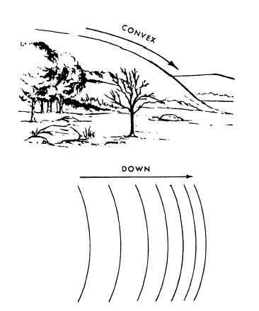
Figure 8-22.-Convex slope
Figure 8-23.-Hill.
Contour lines widely spaced at the bottom indicate a
convex slope (fig. 8-22).
A panoramic sketch is a pictorial representation of
the terrain in elevation and perspective as seen from one
point of observation. This type of map shows the
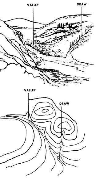
Figure 8-24.-Valley and draw.
horizon, which is always of military importance, with
intervening features, such as crests, woods, structures,
roads, and fences. Figures 8-23 through 8-29 show
panoramic sketches and maps. Each figure shows a
different relief feature and its characteristic contour
pattern. Each relief feature illustrated is defined in the
following paragraphs.
A hill is a point or small area of high ground (fig.
8-23). When you are on a hilltop, the ground slopes
down in all directions.
A stream course that has at least a limited extent of
reasonably level ground and is bordered on the sides by
higher ground is a valley (fig. 8-24). The valley,
generally, has maneuvering room within it. Contours
indicating a valley are U-shaped and tend to parallel a
major stream before crossing it. The more gradual the
8-18