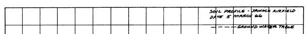
Figure 16-2.—Typical soil profile.
are planned to take advantage of well-draining soils.
Considerations relating to frost action become more
important when frost-susceptible soils are shown on the
profile.
SOURCES OF INFORMATION
Various sources of information are available.
Published information and previous soil analyses are
sources you may secure without field exploration. Time
sources are used mostly to locate, within a large general
area, small areas that you may want to investigate
further. For final site selection, actual field
investigations must be made. Published information
sources include engineer intelligence reports, geologic
and topographic maps and reports, agricultural soil
maps and reports, and air photographs.
Intelligence reports that include maps and studies
of soil conditions are usually available for areas in which
military operations have been planned. Among the most
comprehensive of these are the Terrain Intelligence
Folios prepared by the Intelligence Branch of the U.S
Army Corps of Engineers, in cooperation with the U.S.
Geological Survey.
Geologic maps and brief descriptions of regions or
quadrangles are published in the folios of the U.S.
Geological Survey. Generally, the smallest rock unit
mapped is a formation; geologic maps indicate the
extent of formations by means of letter symbols, color,
or symbolic patterns. Letter symbols on the map indicate
the location of sand and gravel pits; sometimes the back
of the map sheet has a brief discussion entitled “Mineral
Resources,” that describes the location of construction
materials.
Ordinary topographic maps may be of some use in
estimating soil conditions and can be used in
conjunction with geologic maps. Inspection of the
drainage pattern (as indicated by contour lines) can
provide clues as to the nature of rocks, depth of
weathering, soil, and drainage.
Agricultural soils maps and reports are available
for many of the developed agricultural areas of the
world. These studies are usually concerned primarily
with surface soils to a depth of about 6 feet. Information
given includes topography, drainage, vegetation,
temperature, rainfall, water sources, and rock location.
Soils are usually classified according to texture, color,
structure, chemical and physical composition, and
16-7