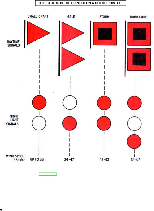
Figure 6-12.--Small-craft, gale, storm, and hurricane warnings.
MARITIME BUOYAGE SYSTEM
(tropical storm), the storm-warning display
indicates that winds ranging from 55 to 73 miles
A buoyage system is a collection of buoys (floating
an hour (48 to 63 knots) are forecast.
markers) placed to guide ships in and out of channels, to
warn them away from hidden dangers, and to lead them
Hurricane warning: Two red flags with black
to anchorage areas. Before 1982, as many as 30
square centers displayed by day or a white light
different buoyage systems were in use around the
between two red lights at night indicates that
world. In 1982 an agreement was signed by all
winds of 74 miles an hour (64 knots) or above are
maritime countries, establishing two international
buoyage regions and condensing all buoyage into one
forecast for the area.
6-13

