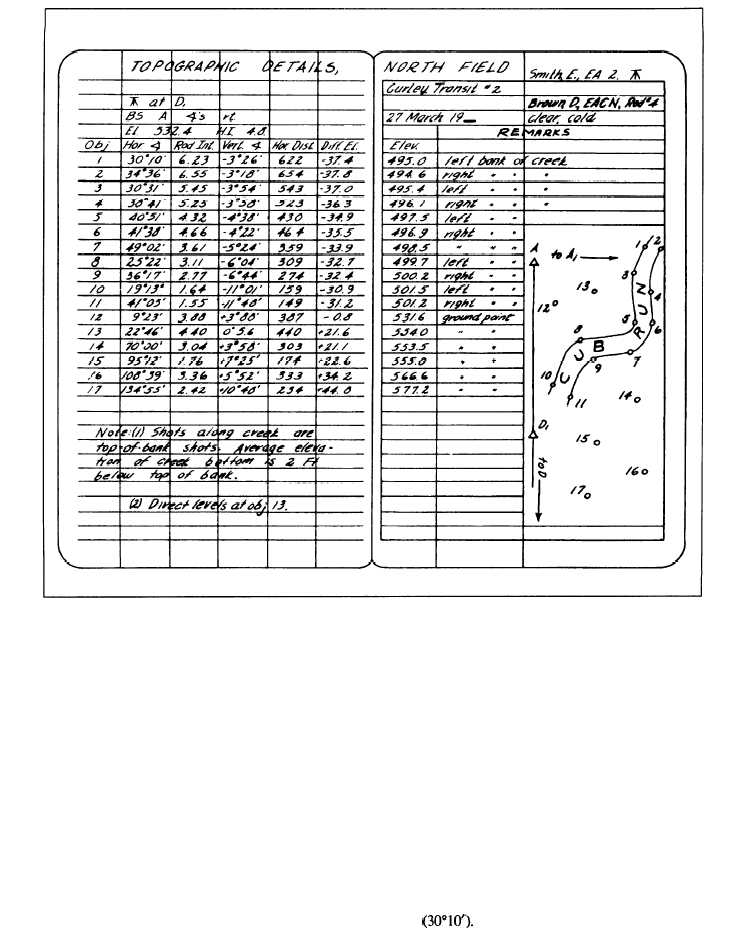
Figure 8-10.-Notes for locating topographical details by transit and stadia.
Now let us see how all that you have learned about
transit-stadia topography is used in the field Figure 8-10
shows field notes for locating topographic details by
transit and stadia. The details shown by numbers in the
sketch on the Remarks side are listed on the data side by
numbers in the column headed Obj. At the top of the
page on the data side, you see that control point D1 was
used as the instrument station. Immediately below this,
you see that from instrument-station D1, the transit was
backsighted to point A and that all horizontal angles
were measured to the right from the backsight on A.
In the third line from the top on the data side, you
see that the known elevation of D1 is 532.4 feet and that
the vertical distance (hi.) from the point or marker at D1
to the center of the instrument above D1 is 4.8 feet. This
vertical distance was carefully determined by
measurement with a tape or rod held next to the
instrument.
Now let us see how each of the objective points was
detailed. We will begin with point 1. Remember that in
this example, D1 is the instrument station from which all
observations are made.
To determine the direction of point 1, train the
transit telescope on A and match the zeros. Next turn the
telescope right to train on point 1 and read the horizontal
angle (30010’).
8-10