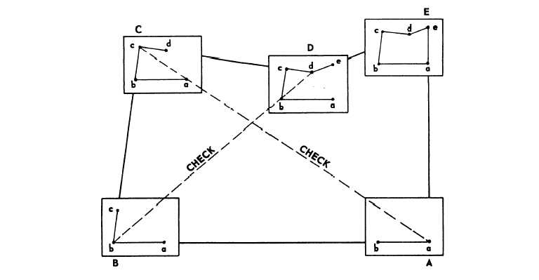
direction and distances to establish positions. This
method of point location is illustrated in figure 9-7.
After you set up and orient the plane table at the
first station, you draw the direction to the next point
on the survey with a radiating ray. The distance
between the occupied station and the new point is
measured and plotted along the ray. The new plotted
position is now considered a known position and can
be occupied and used as the next station on the line.
The plane table is setup and oriented over this station
and another radiating ray is drawn to the next point.
This process continues for the length of the traverse.
Orientation plays an important role in plane-table
traverse. Slight errors in direction at each setup can
accumulate rapidly and become large in a short time.
Long traverses should be avoided except in
reconnaissance surveys.
VALUES OF PLANE-TABLE METHOD
Advantages of the plane-table method of
topographic surveying are as follows:
1. The map is made directly in the field, thus
combining the data collection and drafting into a single
operation. The area under survey is visible as a whole,
which tends to minimum the overlooking of important
data. Errors in measurement maybe easily checked by
taking check observations on a prominent point whose
position has been plotted on the map. If the edge of the
blade does not contact the proper point or points, an
error is indicated. An error thus located can be easily
corrected on the spot.
2. Since all computation and plotting is performed
in the field, the keeping of field notes is not a mandatory
requirement in plane-table topography; the decision is
left up to your supervisor; however, plane-table field
notes are useful as a training device. You should keep
this in mind when, later in your career, you are training
junior EAs in plane-table work.
3. The graphic solutions of the plane table are
much quicker than the same solutions by methods
requiring angular measurements, linear measurements,
and computations. Thus a great deal more area can be
covered in much less time.
4. When the country is open and level, the
plane-table topographer has a wider choice in the
selection of detail points. He need not be hampered by
backsight-foresight requirements. He can locate
inaccessible points easily by graphic triangulation or
quickly determine the location of a point with reference
to one, two, or three points of known location.
5. Irregular lines, such as streams, banks, and
contours, can be sketched.
Figure 9-7.-Progression.
9-6