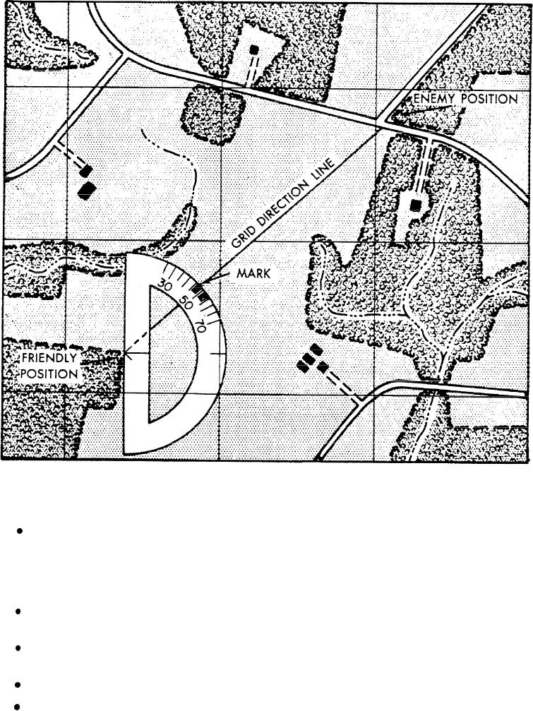
Figure 5-35.--Plotting an azimuth on a map.
Second, holding the 0 - 180 line of the
Intersection
protractor on the known point, slide the protractor in the
north-south direction. Slide it until the horizontal line of
Locating an unknown point by successively
the protractor (connecting the protractor index and the
occupying at least two, but preferably three, known
90 tick mark) is aligned on an east-west grid line.
positions and sighting on the unknown point is called
intersection. It is used to locate features that are not
Draw a line connecting 0, the known point, and
defined on the map or which are not readily
180.
identifiable. The two methods of intersection are the
Holding the 0 - 180 line coincident with this
map and compass method and the straightedge
line, slide the protractor index to the known point.
method.
Make a mark on the map at the required angle.
MAP AND COMPASS METHOD.-- Study the
Draw a line from the known point through the mark
following steps to locate an unknown point using the
made on the map. This is the GRID DIRECTiON line.
5-25

