
Figure 5-5.--Grid square, close-up.
The designation of a point is based on the military
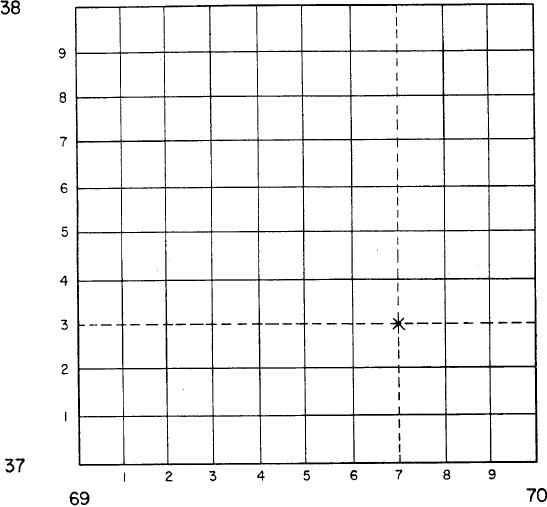
contain an even number of digits. Examples are 6937
and 697373.
principle of "Read RIGHT then UP." The precision
desired determines the number of digits to be read
beyond the principal digits. Remember that the term
Elevation and Relief
grid coordinate often indicates both the 100 000-
meters-square identification and the desired number of
A knowledge of map symbols, grids, scale, and
digits. In many instances, it is a tactical requirement that
distance provides enough information to identify two
the 100 000-meters-square identification be included in
points. You locate them, measure between them, and
any point designation. Figure 5-4 shows a section of a
determine the length of time required to travel between
them. But what happens if there is a 300-foot cliff
simple grid system. Each line is numbered, starting at
between the two points? The map user must also
the lower left-hand corner, reading to the right and up.
become proficient in recognizing the various landforms
Remember, when you read a military map, you should
and irregularities of the surface of the earth. Then he is
always read from left to right and from bottom to top.
able to determine the elevation and differences in the
Three squares in figure 5-4 have numbers in them to
height of all terrain features.
identify that particular grid square. The letter X has been
1. DATUM PLANE. This is a reference from
placed in grid square 6937. To locate this point more
which vertical measurements are taken. The datum
precisely, see figure 5-5. You can see that the sides of
plane for most maps is mean, or average, sea level.
the grid square have been divided into ten parts. This
can be done by eye or with a scale. As shown in this
2. ELEVATION. This is defined as the height
figure, the X is located at coordinate 697373. The grid
(vertical distance) of an object above or below a datum
coordinates are written as one number but always
plane.
5-9