designated as a standard time meridian. Each time
meridian runs through the center of its time zone, which
means that the zone extends for 7°30' on each side of
the meridian. In each zone, the time is the same
throughout the zone.
There is a 1 hour difference in time between a
particular zone and the adjacent zone. When
determining time in different zones, it is helpful to
remember this phrase: time is later as you move
eastward. So, if it is 1200 in your zone, it is 1300 in the
next zone to the east and 1100 in the next zone to the
w e s t.
ZONE TIME AND GREENWICH MEAN
TIME.— The time listed in most of the computational
tables used in celestial observations is Greenwich mean
time (GMT)— meaning the zone time in the Greenwich
standard time zone. You must know how to convert the
zone time at which you made a particular observation to
Greenwich mean time. The procedure is as follows.
Each of the time zones has a number that is called
the zone description (ZD). The Greenwich zone is
numbered 0. The others are numbered from 1 through
12, east or west of Greenwich. To determine the ZD for
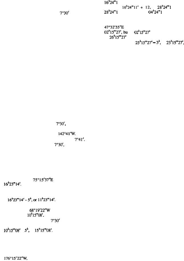
any point on the earth, you divide the longitude by 15.
If the remainder is greater than 7030', the quotient plus
1 is the ZD. Suppose, for example, that the longitude at
the point of your observation is . Divide this
by 15 and you get 9, with a remainder of 7041'. Since
the remainder is greater than 7030', the ZD is 9 + 1, or
10.
Zones east of Greenwich are minus and zones west
of Greenwich are plus. To convert the zone time of an
observation to the corresponding Greenwich meantime,
you apply the ZD according to its sign to the zone time.
For example, suppose the longitude at your point of
observation is 75°15'37"E and the zone time is
16"23m14s. Divide the longitude by 15 and you get 5,
with less than 7°30' left over. ‘The longitude is east;
therefore, the ZD is -5; and the GMT of the observation
Suppose now that the longitude of the point of
observation is and the zone time of the
observation is 10h15m08’. Divide the longitude by 15 and
you get 4, with more than 7°30" left over. The ZD is
therefore +5; and the GMT of the observation is
10h15m08’ + 5h, or 15’’15m08S.
ZONE TIME AND DATE.— It may be the case
that the date at Greenwich and the date at the point of
observation are not the same at the time of observation.
Suppose that on 1 May you are in longitude
and the zone time of your observation is
16’’24”1ls. The ZD is +12. GMT of the observation is
therefore or 28h24mlls.
However,
28h24ml1’ on 1 May means 04h24ml1s on 2 May, and you
would refer to the tables for that GMT and date.
Suppose now that on 1 May you are in longitude
and the zone time of the observation is
but 02h15m27s on 1 May can be considered
as 26h15m27s on 30 April. Therefore, GMT for the
observation was 25h15m27s – 3h, or 23h15m27s, on 30
April.
Importance of Exact Time
The importance of recording the exact time at
which an observation is made may be illustrated as
follows. Suppose a ship’s navigator makes an error of
only 1 minute in his time. This could produce an error
of as much as 15 miles in the location of his computed
and plotted line of position. A 1-minute time error
produces a 15-minute error in longitude regardless of
the latitude; and on the equator, a minute of longitude
equals a nautical mile.
You must time the observation to the nearest second,
and for this purpose, you must have an accurate watch.
It is best that you have an accurate ordinary watch plus
a stopwatch. You should set the ordinary watch to exact
time shortly before the time of observation. Correct
standard time can be obtained from a clock known to be
closely regulated, or preferably from time signals
broadcast by the U.S. Naval Observatory.
Remember, too, that in localities under daylight
savings time, the time is 1 hour faster than standard time.
ELEMENTS OF FIELD ASTRONOMY
Although the earth is not actually a true sphere, it is
presumed to be such for the purpose of astronomy.
Astronomic determinations are based on the
relationships that exist among sets of spherical
coordinates: the terrestrial system stated in latitude and
longitude; the celestial system of right ascension and
declination, or its subsidiary system of hour angle and
declination; and the horizon system in terms of altitude
and azimuth.
Terrestrial System of Coordinates
The terrestrial system of coordinates refers to the
location of points on the terrestrial sphere (the earth). In
the terrestrial system, the fundamental reference lines
(fig. 15-1) are the axis of the earth’s rotation and the
earth’s equator. The ends of the axis of rotation are
known as the poles, designated as the North and South
is
15-2