In order to use a map effectively in the field for
purposes of identification, location, or reporting, you
must orient, or align, the map with the ground. A map
is oriented when, in a horizontal position, its north
points to the north and all map lines are parallel to
their corresponding lines on the ground. A map user
is oriented when he knows his position on the
oriented map.
A fast and accurate way to orient a map is with a
lensatic compass. When a compass rose (picture of a
compass card) appears on the map, place the map on
a flat surface and draw the magnetic north line. Open
the compass and place it over the magnetic north line
so the sight points toward the top of the map and is
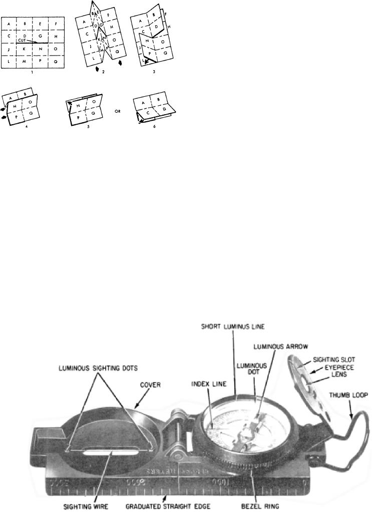
Figure 5-25.--How to slit and fold.
directly over the magnetic north line that you have
drawn. Turn the map, taking care not to move the
as grid and magnetic declination data or overlapping
compass from its position over the north line until the
grid values and ticks.
north arrow of the compass is aligned under the index
line of the compass. The map is now oriented. For
maps that do not have a compass rose, align the
LENSATIC COMPASS
compass sights over a north-south grid line. Then
rotate the map and compass together until the north
arrow of the compass points in the same direction and
The lensatic compass is the most commonly used
amount from the grid line, shown in the declination
and simplest instrument for measuring directions and
diagram.
angles in the field. Two varieties of magnetic
To orient a map when a compass is not available
compasses are standard for military use today: the
requires a careful examination of the map and the
lensatic compass (fig. 5-26) and the artillery (M2)
ground features of the area to find linear features that
compass. Since the M2 is a special-purpose compass,
are common to both the map and the ground. Linear
it is not discussed in this chapter.
Figure 5-26.--Lensatic compass.
5-19

